

|
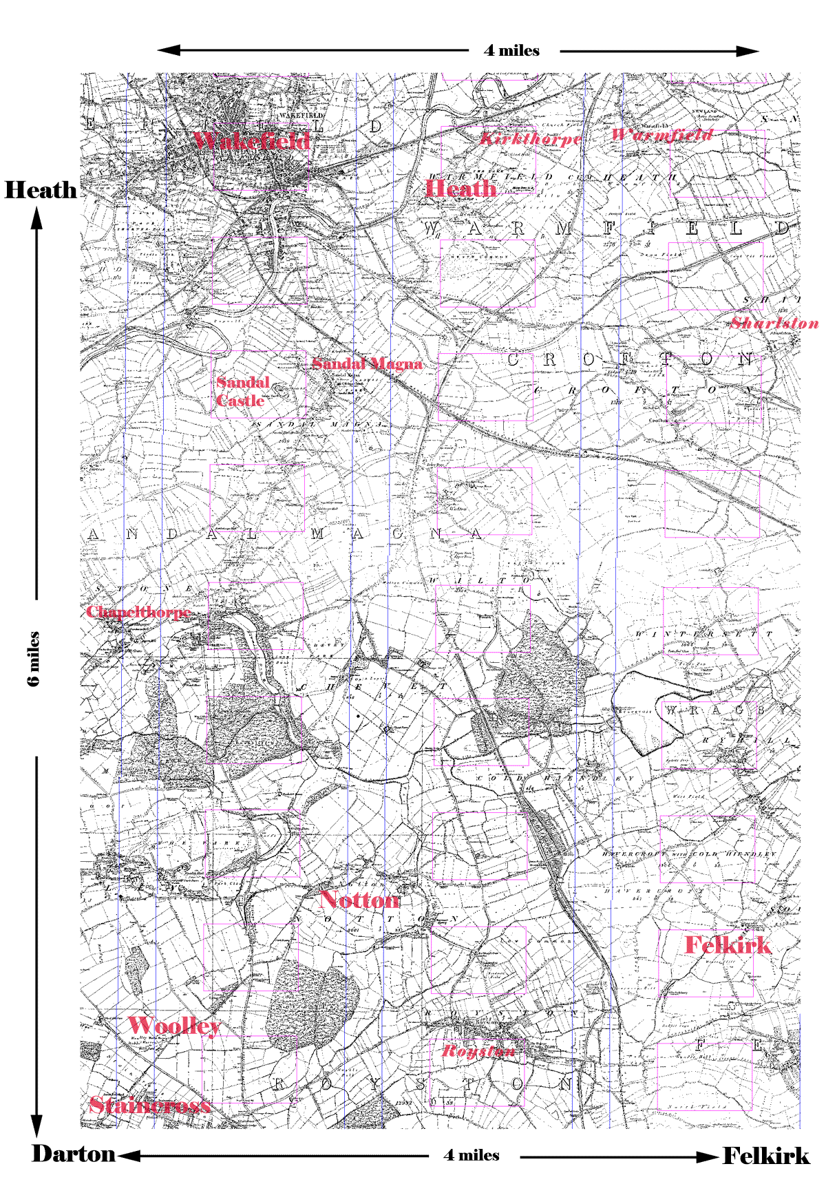
This is a map of Felkirk, Staincross and Heath This map is circa 1850, and serves two purposes. It gives an idea of the general geography of the area and the distances between the various villages and in particular between Felkirk and Staincross and Staincross and Heath. It also serves to locate the photographs. Clicking on the place-name links will take you to relevant photographs and explanatory narratives. |
|
|
|
|
The copyright of this website 2002 to 2008 belongs to the web owner. No part of this website may be sold, used for commercial
purposes or republished in any form, either in print, electronically
or otherwise, without the express permission of the web owner.
Any person, company or organisation found to be in breach of
the foregoing will be liable to prosecution. |